Project Caos - Open World Design
- Guilherme Martins

- Mar 3
- 4 min read
Updated: Mar 6
Role: Senior Level Designer / Game Designer
Tools: Unreal Engine 5, Maya
Studio: 1% Games Studio
IP: Project Caos
Gender: Action-adventure
Platform: PC
Summary
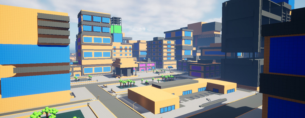
- Overview: This project is a fully playable urban district designed using Kevin Lynch’s Five Elements of City Imageability (Paths, Edges, Districts, Nodes, and Landmarks) as a foundation for creating a clear and memorable player mental map. The level applies principles of cognitive mapping and environmental psychology to support intuitive navigation, spatial awareness, and exploration within an open-world city context. The overall layout draws inspiration from classic urban open-world games such as GTA III and GTA Online, focusing on readability, recognizable spaces, and natural player flow.
- Briefing: Build a strong mental map using Paths, Edges, Districts, Nodes, and Landmarks. Improve wayfinding and navigation through spatial hierarchy and visual cues. Encourage exploration and discovery within a believable urban layout. Apply environmental psychology to reinforce player orientation and memory
- Design Ownership: Designed the district from initial blockout to final layout. Structured the space using Lynch’s five elements to guide player navigation. Placed landmarks, nodes, and edges to support orientation and flow. Built streets, open spaces, and architectural composition for readability. Iterated on layout based on player movement patterns and navigation clarity

The Level Breakdown
Briefing
Design a fully playable urban district centered on navigation clarity, spatial memory, and player-driven exploration.
The level was built to:
establish a strong mental map using Kevin Lynch’s five elements
improve wayfinding through spatial hierarchy and visual composition
encourage exploration through readable urban structure
support navigation through cognitive mapping and environmental psychology
communicate city identity through architecture, landmarks, and production design
The core pillar was spatial legibility.
Every space needed to answer the player’s question: where am I, where can I go, and what draws my attention.

Flow structure
The level is built around a readable urban hierarchy.
primary paths establish city structure and long-distance navigation
secondary streets support exploration and local discovery
district transitions signal identity shifts and pacing changes
nodes act as decision points and orientation resets
landmarks anchor the player’s mental map
edges guide movement and define spatial limits
This structure encourages players to internalize the city rather than rely on maps or UI markers.
Player Flow
Entry:
Players enter the district through a primary path that introduces the main spatial language. Major landmarks are visible early to establish orientation anchors.
Initial orientation:
Edges, streets, and district transitions begin forming a mental structure.
Players recognize safe traversal routes and high-activity areas.
Exploration phase:
Multiple routes open across different districts.
Nodes such as plazas and intersections become decision-making points.
Mental mapping:
Landmarks and repeated spatial patterns reinforce memory.
Players begin navigating without relying on UI guidance.
Spatial confidence:
Traversal becomes intentional rather than exploratory.
Players move toward goals using environmental cues and spatial understanding.
Mastery:
The district transforms from a confusing urban space into a readable network of paths, districts, and recognizable anchors.
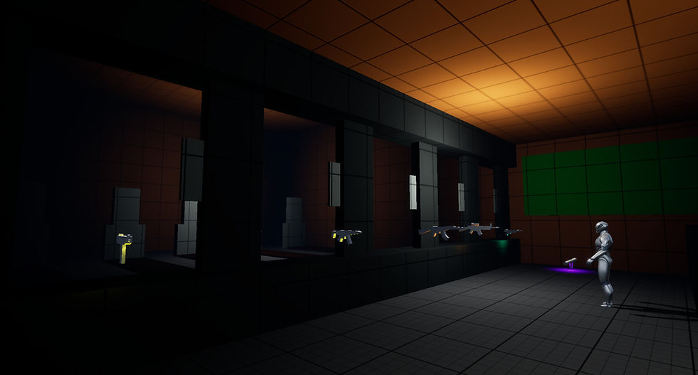
Gameplay Demo
Spatial logic: Kevin Lynch in practice
Paths:
Main roads, alleys, and traversal corridors define player movement patterns and navigation rhythm.
Edges:
Rivers, walls, elevation shifts, and industrial boundaries shape district identity and guide direction.
Districts:
Each area has a distinct architectural language, density, and atmosphere, reinforcing spatial recognition.
Nodes:
Intersections, plazas, transport hubs, and activity centers serve as orientation and decision spaces.
Landmarks:
Unique vertical silhouettes and focal structures support long-distance navigation and memory retention.

Cognitive mapping and environmental psychology
Navigation is designed around how players mentally construct space.
spatial repetition reinforces memory
visual hierarchy reduces cognitive load
landmarks support orientation at multiple distances
district identity supports recall and emotional attachment
edges prevent disorientation while preserving openness
Players build familiarity through movement, not instruction.
Production design influence
Cinematic production design principles shape attention and navigation.
framing guides player gaze
lighting contrast suggests movement
architectural composition directs flow
spatial staging supports narrative context
The environment communicates intention through composition rather than UI.

Design Ownership
designed the district from blockout to final layout with focus on readability
structured the environment using Paths, Edges, Districts, Nodes, and Landmarks
created spatial hierarchy through street scale, density, and composition
placed landmarks to support orientation and navigation memory
designed nodes as decision-making and pacing spaces
applied environmental psychology to reduce navigation friction
used cinematic production design techniques to guide player attention
iterated on layout using playtest data focused on confusion points and movement patterns
Design Shortcomings
Playtesting revealed navigation and readability issues:
players relied too heavily on UI instead of environment
district identity was initially too similar
landmarks lacked visibility from distance
edges sometimes felt like barriers instead of guidance
nodes lacked strong visual pull
exploration felt unfocused in early layouts
The city initially felt visually rich but cognitively unclear.
Iterative Process
Iteration focused on strengthening spatial identity and navigation clarity:
increased contrast between districts
repositioned landmarks for long-distance visibility
refined path hierarchy for clearer movement logic
strengthened node composition and visual framing
adjusted edges to guide rather than restrict
introduced environmental cues reinforcing direction
simplified complex intersections causing confusion
Changes were driven by player navigation behavior and spatial memory breakdowns observed in playtests.
Delivered Experience
The final district delivers a readable and memorable urban environment built on cognitive mapping and spatial hierarchy.
Players:
navigate using landmarks rather than UI
recognize districts through identity and atmosphere
develop spatial confidence over time
explore intentionally rather than randomly
form a mental map of the city through repetition
The level demonstrates:
urban readability and navigation design
application of Kevin Lynch’s city imageability
cognitive mapping in level design
environmental psychology in player orientation
production design applied to spatial guidance
iteration driven by player behavior and movement patterns
The city functions not only as a setting, but as a navigational system that teaches players how to read, remember, and move through space.
Urban Level Design • Open World • Cognitive Mapping • Player Navigation • Environmental Psychology • Environmental Storytelling • World Building