Highstreet World: Highstreet City
- Guilherme Martins

- Feb 6
- 5 min read
Updated: Mar 6
Role: Senior Level Designer / World Designer / Content Designer
Tools: Unity, Probuilder, Maya
Studio: Highstreet
IP: Highstreet World
Gender: MMORPG/ Roguelike
Platform: VR/PC
Summary
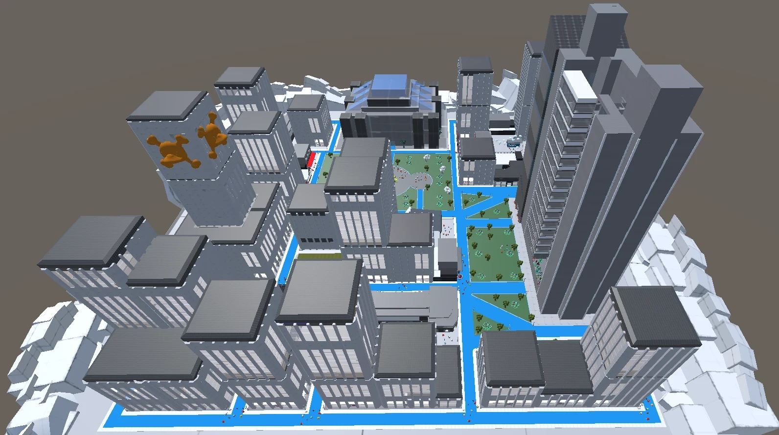
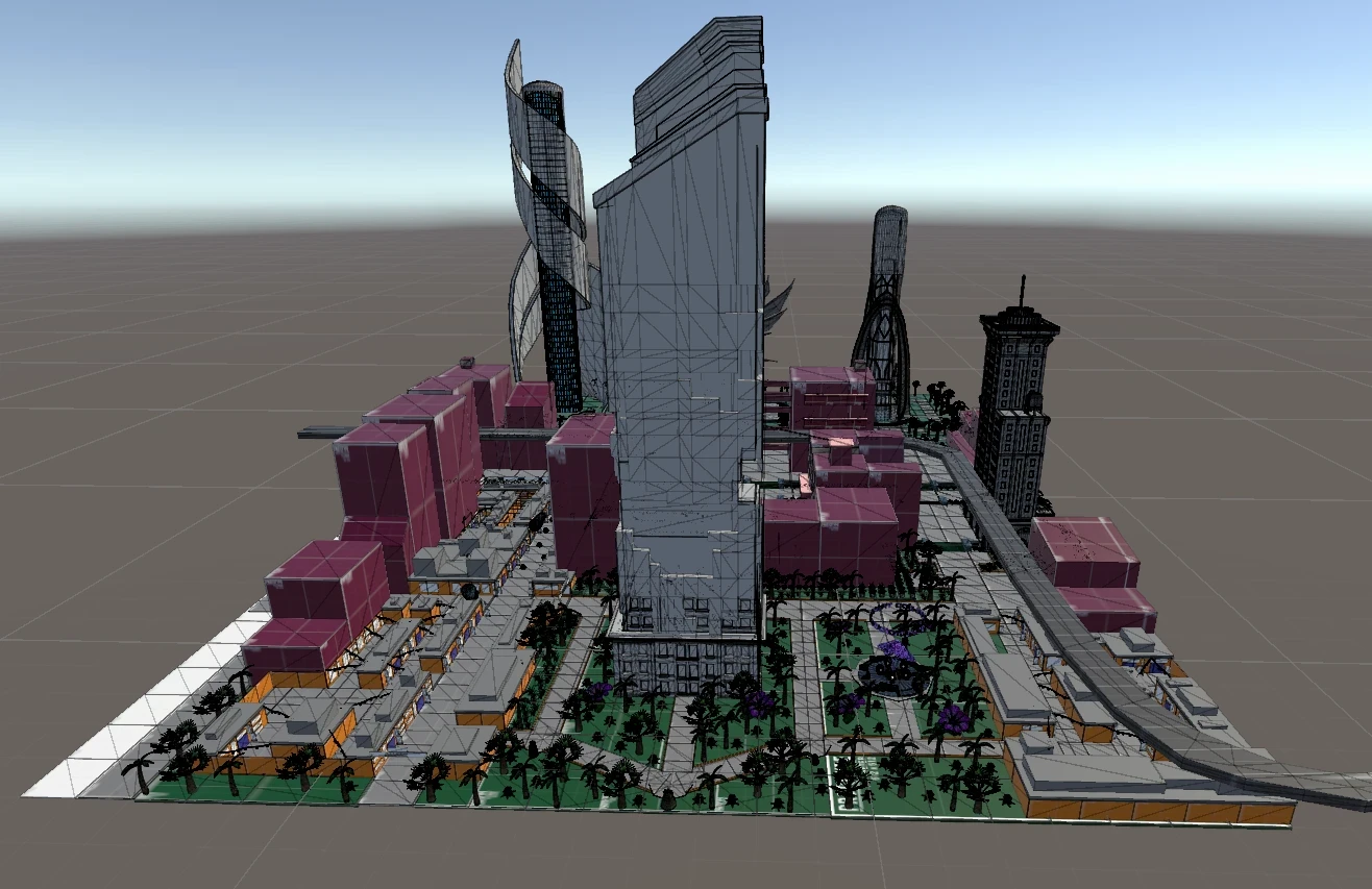
Overview: This project is a fully playable urban district designed to emphasize navigation clarity, spatial memory, and environmental storytelling. The area combines cinematic world logic with Kevin Lynch's five elements of urban form - Paths, Edges, Districts, Nodes, and Landmarks - to create a city that is both functionally readable and emotionally engaging. Narrative context is conveyed through layout, architecture, lighting, and atmosphere, allowing players to understand and feel the world without explicit exposition.
Briefing: Build a strong player mental map using Lynch's five urban elements. Ensure consistent world logic through coherent architectural and narrative rules. Improve wayfinding and orientation through landmarks, nodes, and spatial hierarchy. Support exploration and immersion using environmental storytelling and cinematic composition.
Design Ownership: Designed the entire city from initial blockout to final layout. Structured paths, edges, districts, nodes, and landmarks to guide player navigation. Applied world logic principles to architecture, scale, and atmosphere. Created cinematic paths and nodes inspired by film production design. Iterated on layout and readability based on player movement and navigation tests.

Level Breakdown
Briefing
Design a fully playable urban district where the city itself becomes the navigation system.
The level was built to:
• build a strong player mental map without relying on minimaps or UI markers
• apply Kevin Lynch's five elements of urban form as the structural foundation
• ensure consistent world logic through coherent architectural and narrative rules
• support spatial memory through readable districts, paths, and landmark anchors
• deliver environmental storytelling through composition, scale, and atmosphere
The core pillar was navigation through spatial identity.
Every district needed to feel distinct. Every path needed a destination. Every landmark needed to earn its place on the player's mental map.
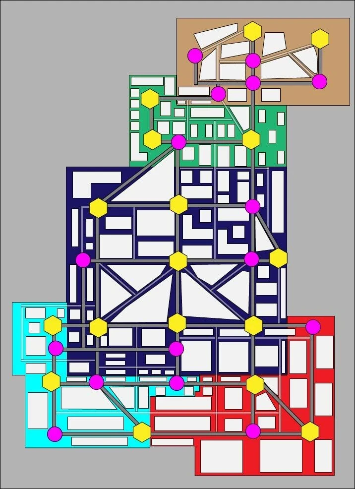
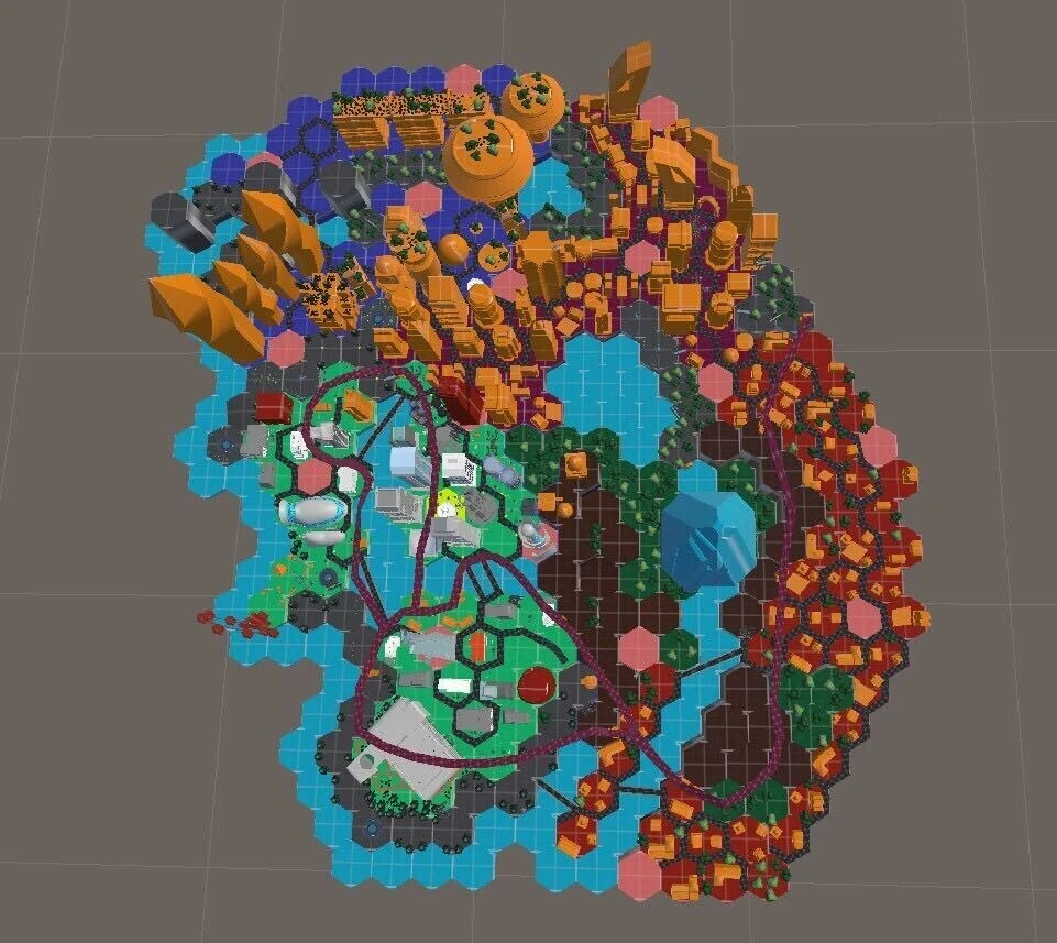
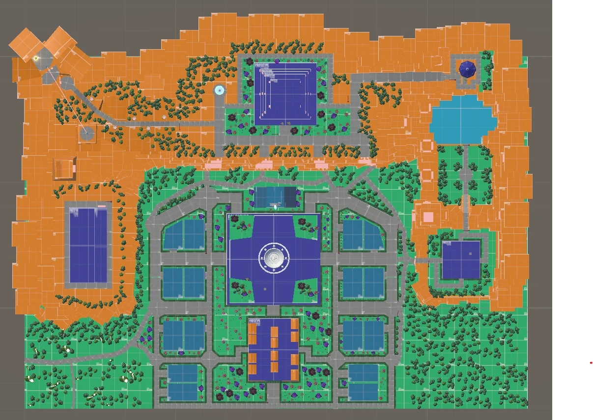
Design Framework - Kevin Lynch's Five Elements
The district is structured entirely around Lynch's five elements of city imageability. Each element serves a functional design purpose, not a theoretical one.
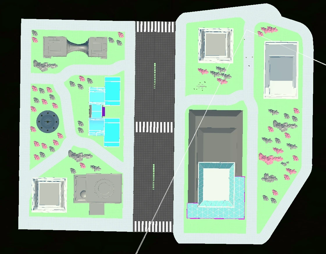
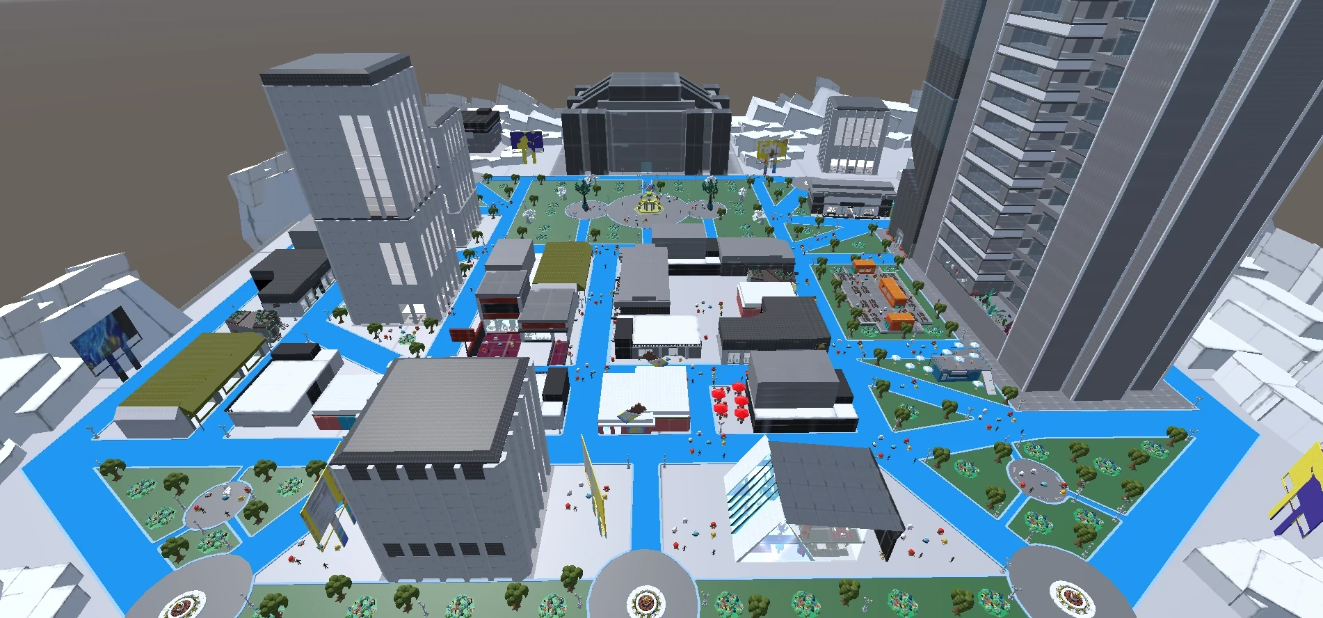
Paths - movement corridors that define how players travel through the city.
• primary streets establish clear direction and orientation
• secondary alleys create shorter routes and discovery opportunities
• cinematic framing used at key intersections to guide player gaze
• path width communicates urban hierarchy - wider means safer and more central
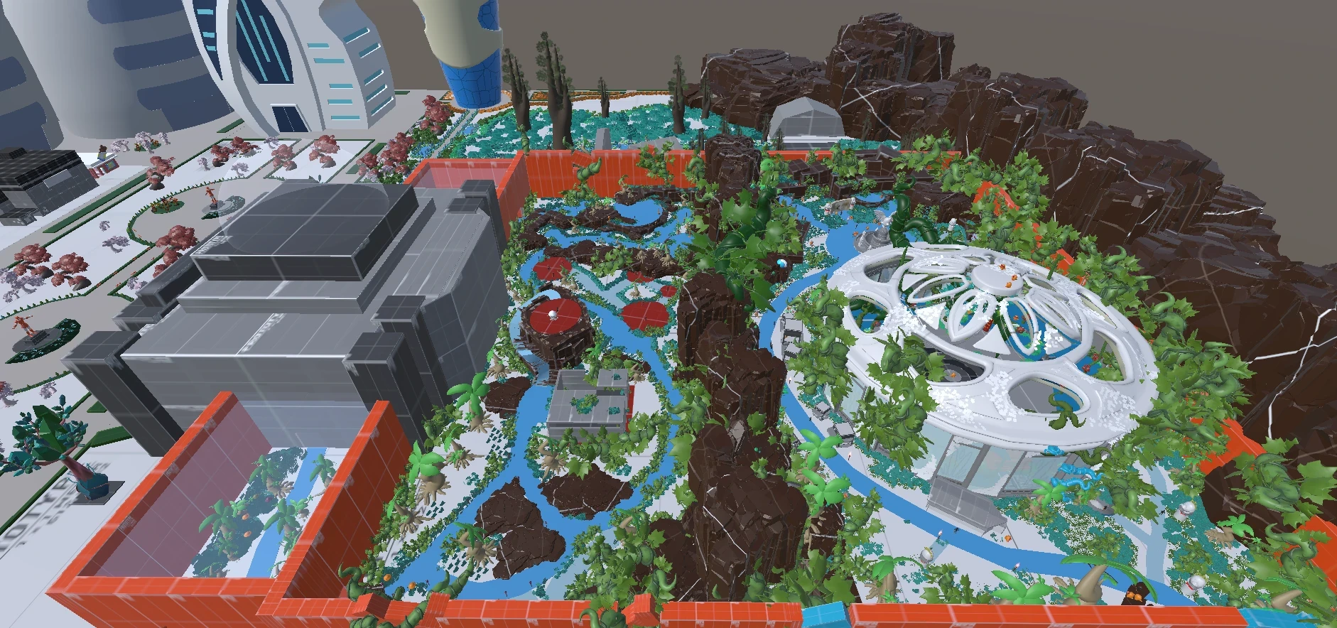
Edges - boundaries that define district limits and separate spatial zones.
• rivers, walls, and elevated rails act as hard spatial boundaries
• edges prevent player disorientation by containing district identity
• transitions between edges signal a change in atmosphere and world logic
• some edges are permeable - players can cross them but feel the shift
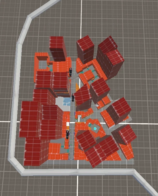
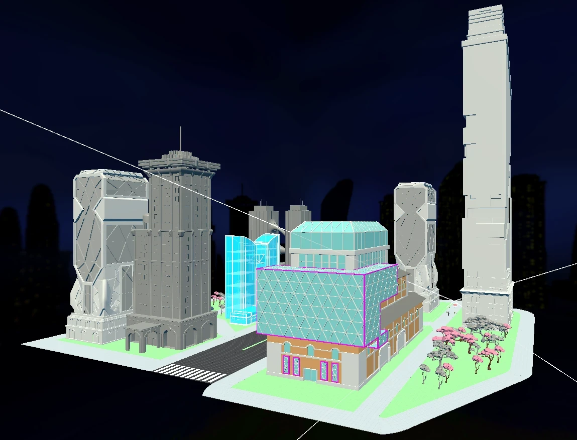
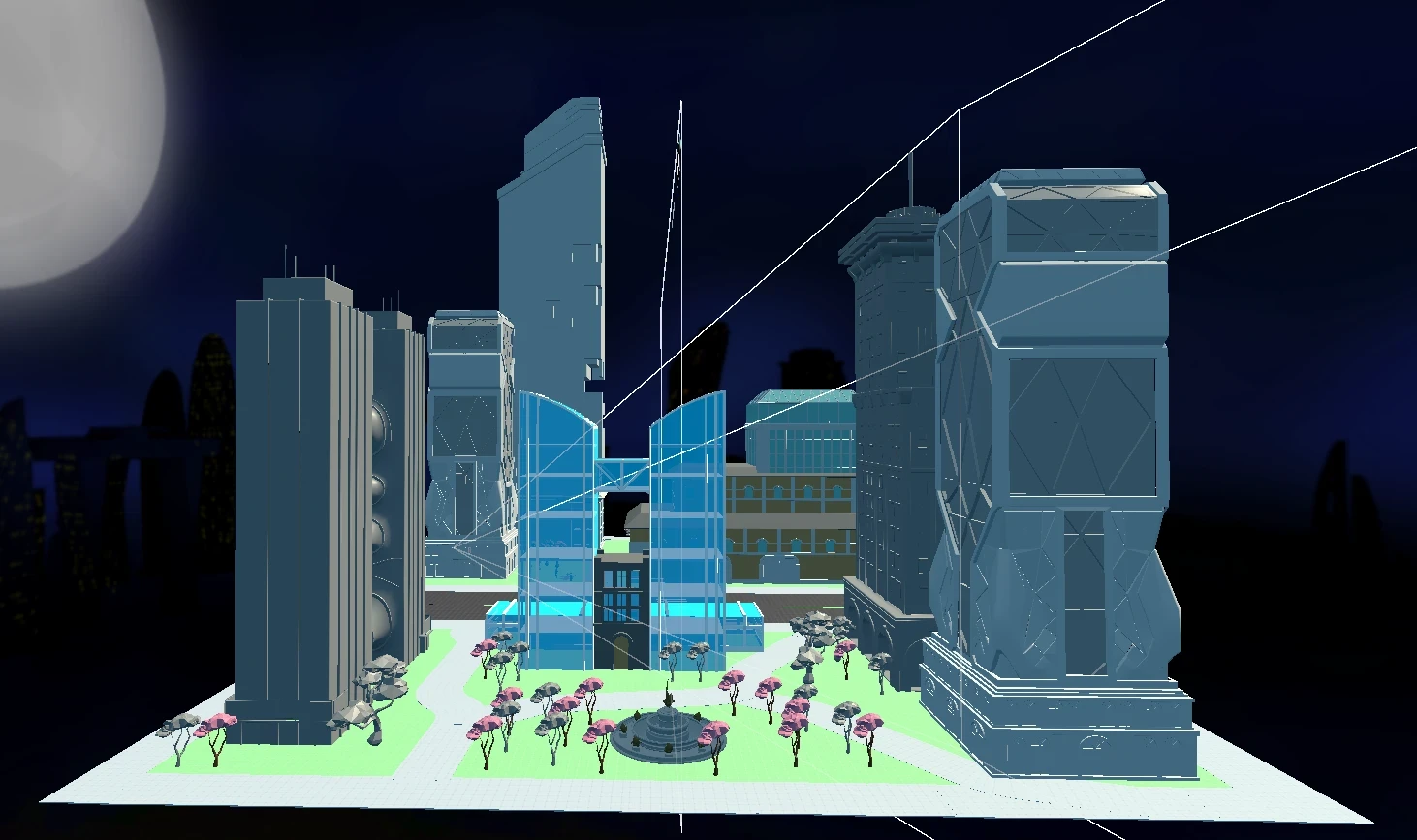
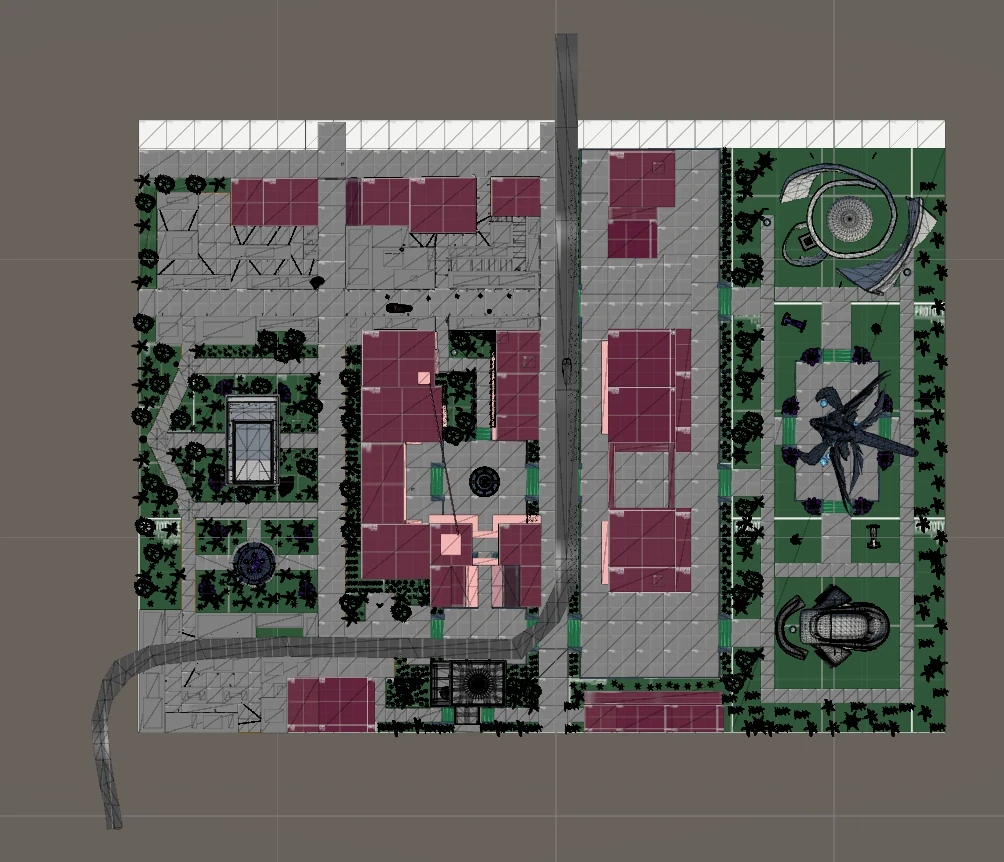
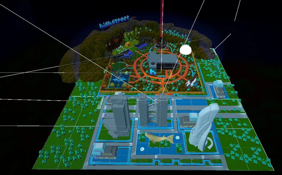
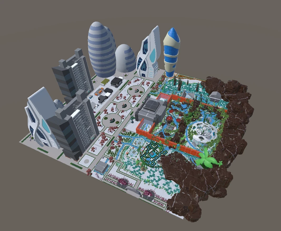
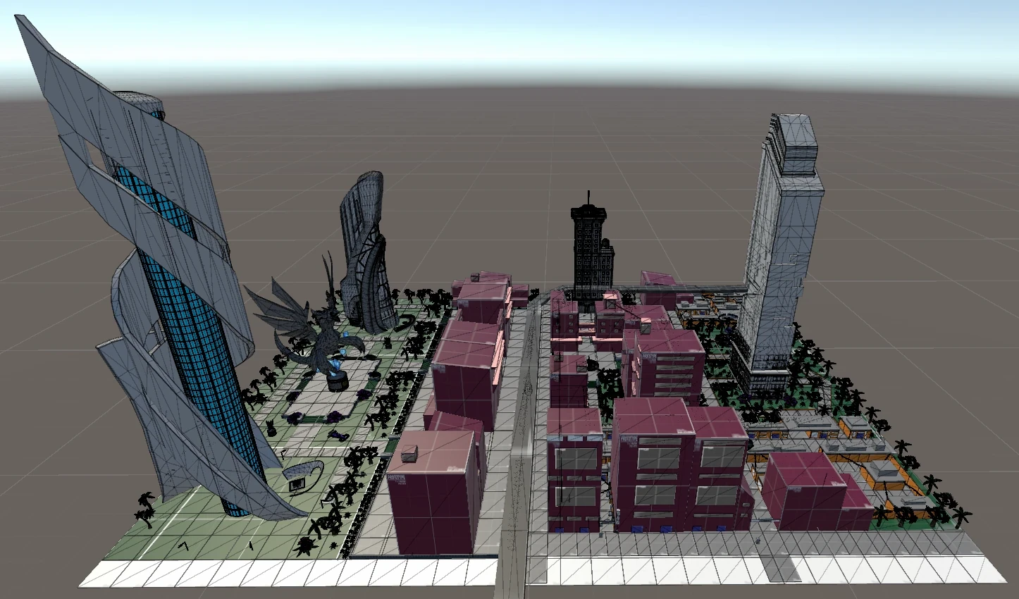
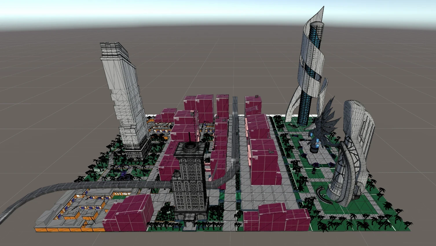
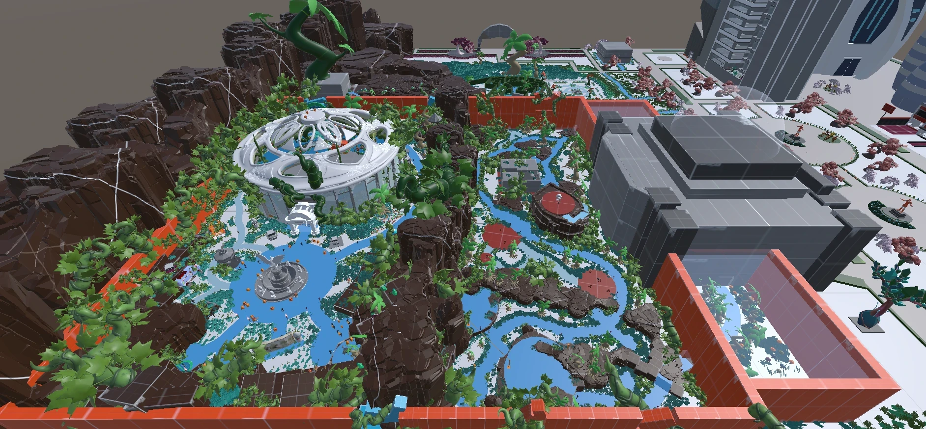
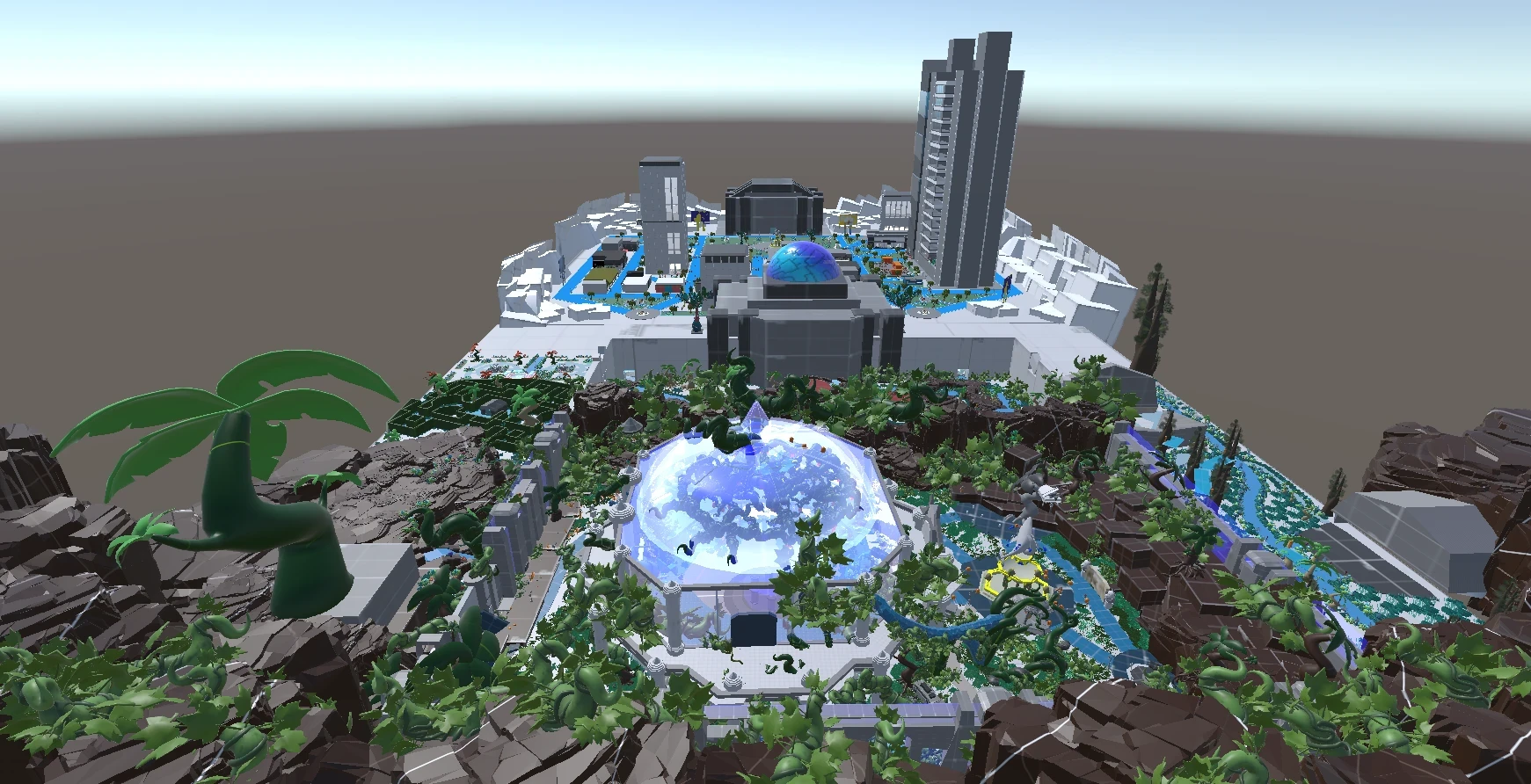
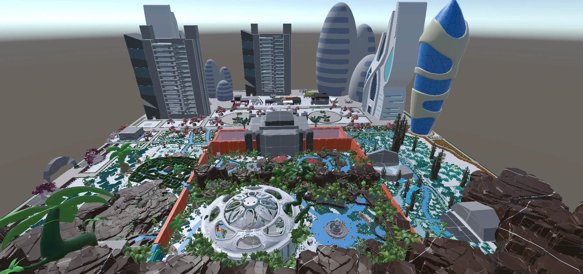
Districts - areas with distinct identity that players learn to recognise and name.
• each district has a dominant material, colour temperature, and architectural language
• social, commercial, industrial, and abandoned zones each read differently at a glance
• district identity is communicated through architecture, not signage
• players develop vocabulary for the city - they begin to name places themselves
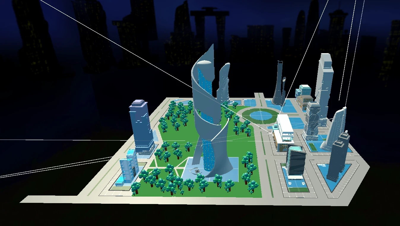
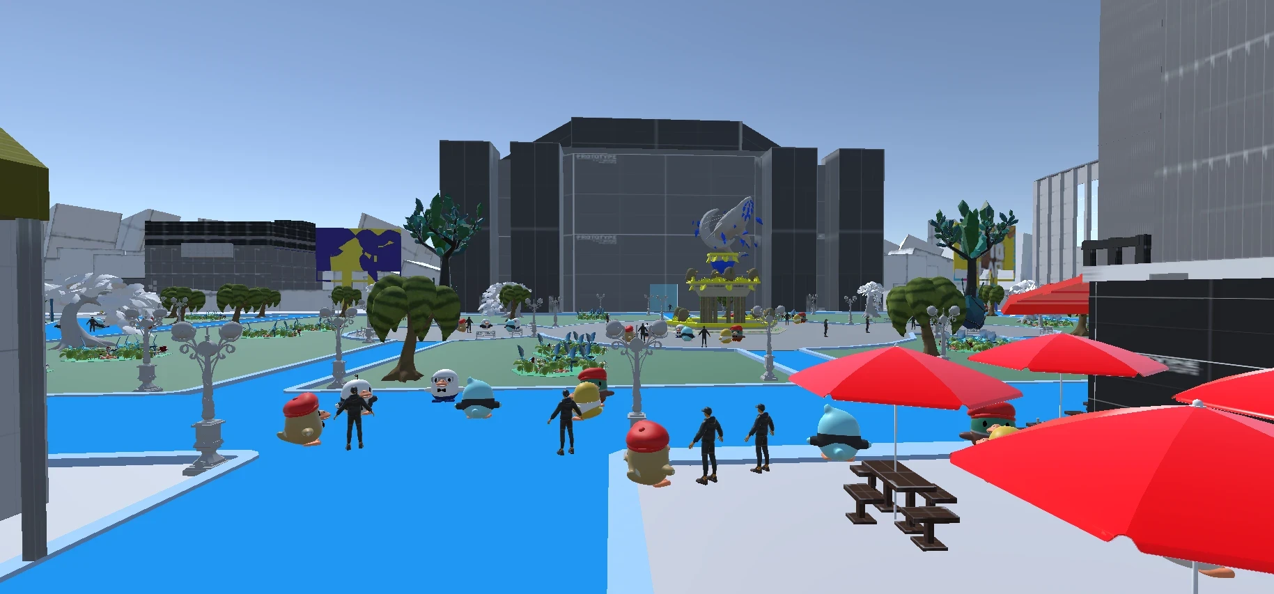
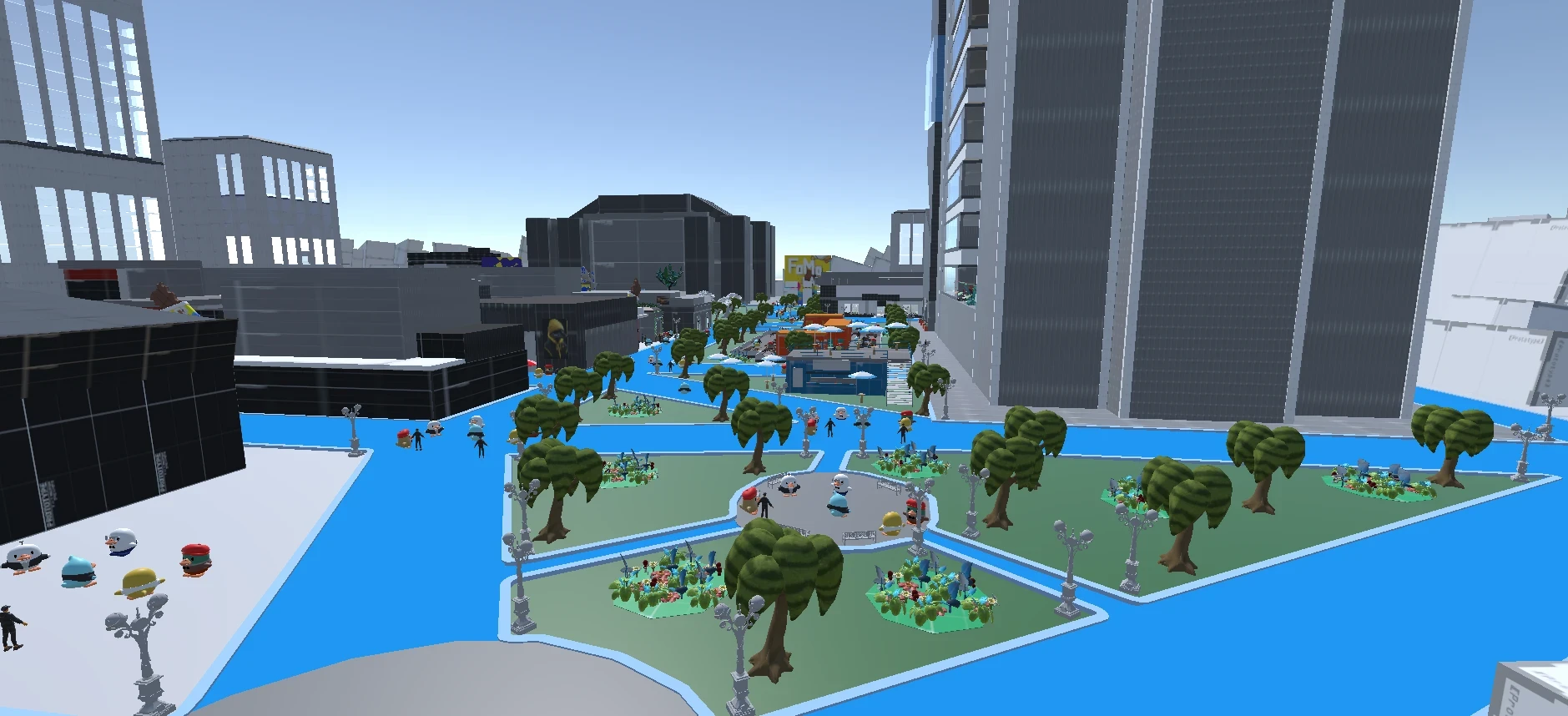
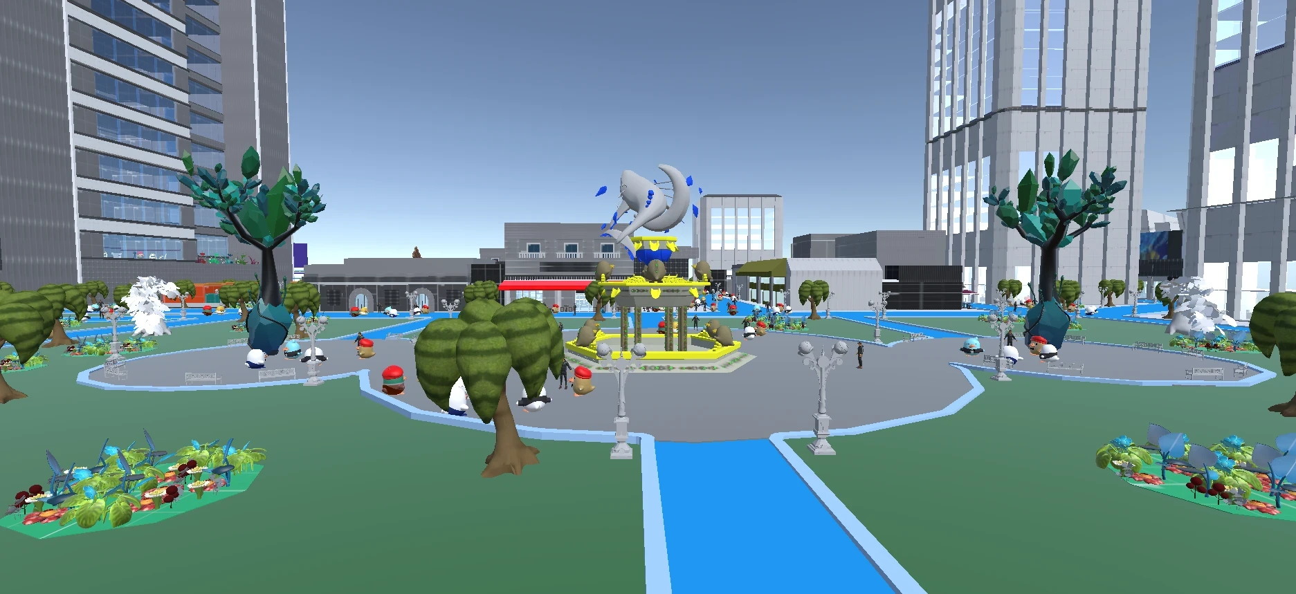
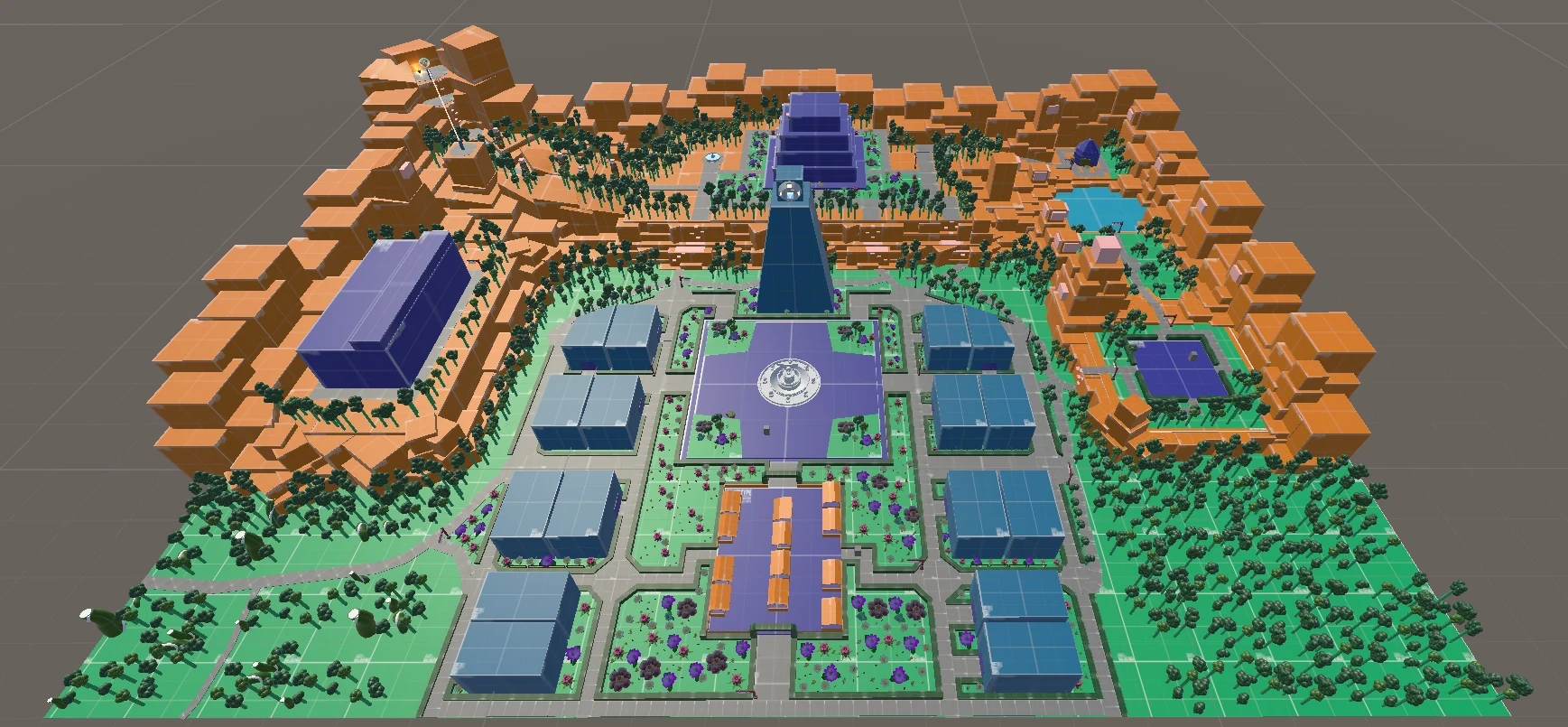
Nodes - focal points that attract players and anchor spatial memory.
• central plazas, market intersections, and elevated viewpoints function as nodes
• nodes are positioned at path intersections to maximise orientation value
• players naturally gravitate toward nodes when lost
• social and commercial activity reinforces node identity over time
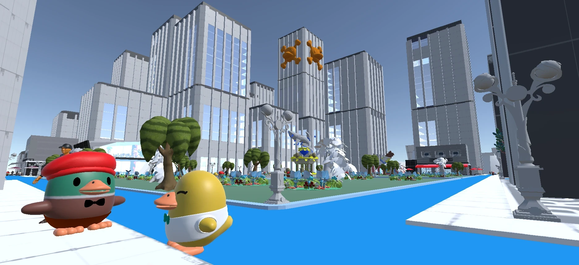
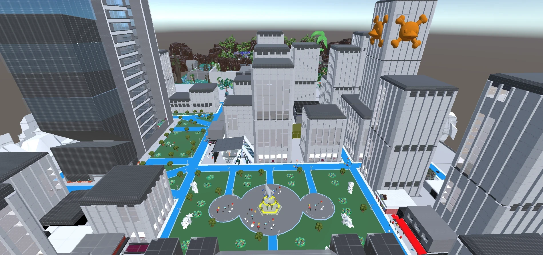
Landmarks - singular, memorable elements used for distance orientation.
• the city tower, industrial chimney, and collapsed bridge function as landmarks
• landmarks are visible from multiple districts to enable triangulation
• each landmark has a unique silhouette readable at long range
• players orient themselves by landmark before engaging with path or node

Flow Structure
The district is designed as a layered spatial system, not a linear path.
• primary paths establish city-scale movement corridors
• district edges contain spatial identity and prevent cognitive bleed
• nodes act as navigation anchors and social attractors
• landmarks enable triangulation across the full map
• secondary paths reward curiosity and local exploration
This structure allows players to navigate confidently without UI assistance.
Spatial memory replaces the minimap. The city teaches itself.
Player Flow
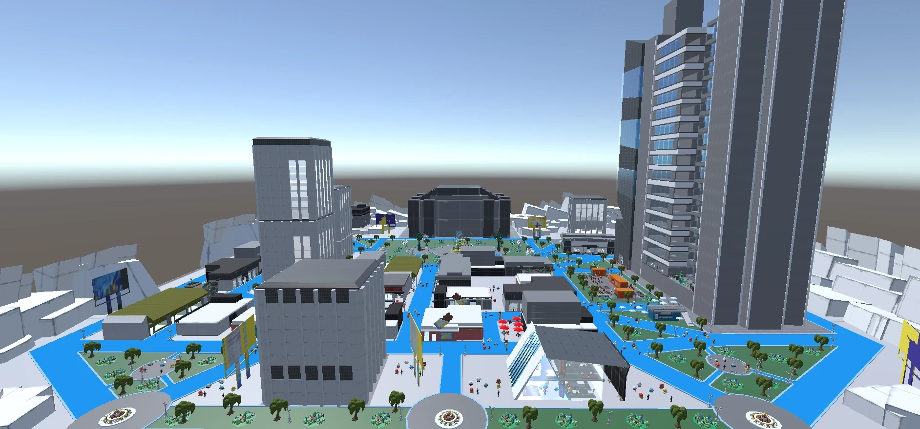
Arrival - orientation through visual hierarchy:
• players enter the district from a readable threshold - a gate, bridge, or elevated transition
• the first landmark is immediately visible, establishing a reference point
• the primary path ahead is wider, brighter, and more populated than side routes
Early exploration - district reading:
• material language and lighting temperature communicate district identity
• players begin to associate architectural cues with zone type
• first node encountered functions as a social and navigational anchor
Spatial learning - mental map construction:
• players recognise recurring landmarks from new vantage points
• district edges become legible - players know where one area ends and another begins
• secondary paths become visible as player confidence increases
Navigation mastery - city as system:
• players navigate by landmark and node without conscious effort
• shortcuts through alleys and edges become preferred routes
• the city no longer feels like a level - it feels like a place
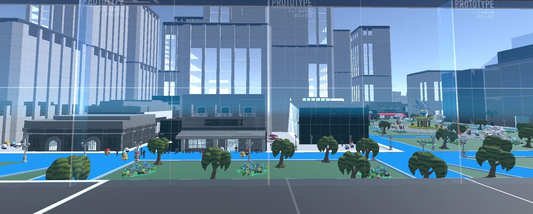
World Logic - Cinematic Urban Design
The district applies film production design principles to reinforce spatial coherence.
• architectural rules are established early and followed consistently throughout
• every building communicates its function through form, scale, and material
• street-level detail is designed for third-person walking speed, not aerial photography
• lighting and atmosphere shift across districts to reflect economic and narrative status
• environmental decay is used deliberately - wear and damage tell spatial history
World logic is not decoration. It is the navigation system.
Players trust the world because the world is consistent.

Environmental Storytelling
Narrative is delivered through space rather than text or dialogue.
• abandoned districts communicate economic collapse through overgrowth and closure
• industrial zones show labour history through machine scale and material wear
• commercial nodes communicate activity through density and lighting warmth
• transitions between districts tell the story of who lived where and why
• cinematic framing at key paths creates composed views that reward exploration
Players do not read the world. They feel it.
Understanding arrives through traversal, not exposition.
Design Shortcomings
Playtesting revealed several structural issues:
• early district layouts felt visually distinct but spatially similar in scale
• some landmarks lacked unique silhouettes - players confused them at distance
• secondary paths were underused because primary paths were too efficient
• district edges in some areas felt arbitrary rather than spatial or narrative
• node placement in early iterations was too uniform - all nodes felt equal
The city read correctly on paper but did not always teach itself in practice
Iterative Process
Iteration focused on spatial legibility and navigation confidence:
• reinforced landmark silhouette uniqueness - each landmark reads differently at 200m
• introduced spatial rewards on secondary paths to incentivise off-axis exploration
• redesigned district edges to align with narrative logic rather than invisible boundaries
• created node hierarchy - primary nodes are larger, more active, and more central
• adjusted path width contrast to make hierarchy immediately readable on arrival
• strengthened district identity by committing harder to material and lighting rules
Changes were driven by observed player navigation behaviour, not design intent alone.
If players needed the minimap, the space had failed.
Delivered Experience
The final district functions as a city that players learn rather than a level they complete.
Players:
• navigate confidently without minimap assistance after a single full traversal
• describe districts by feel rather than by name - the design language did its job
• use landmarks to triangulate position across the full map
• discover secondary paths and treat them as personal knowledge
• form spatial memory that persists across sessions
The city does not explain itself. It reveals itself.
Urban Level Design • Open World • Cognitive Mapping • Player Navigation • Environmental Psychology • Environmental Storytelling • World Building